
Location of the crash
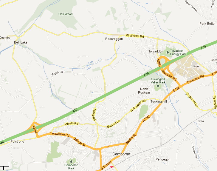
The crash site is approximately one and a half miles due North of Camborne town centre. For those of us not travelling by air; take the Tehidy Road out of Camborne and the crash site is roughly half a mile past the A30 bridge at the junction with Treverno Road. If travelling on the A30, leave the A30 at the Tolvaddon junction and head North towards Tehidy. At the second roundabout turn left onto Mt Whistle Road and continue for approximately 1/2 mile. Take the road that forks to the left signposted for Rosewarne and Camborne and the site is about half a mile down this road on the left at the junction with Treverno Road. Beware looking for directions to Roscroggan Chapel - there were two chapels in Roscroggan; the surviving one is now a bed and breakfast.
Little now remains of the chapel that was hit by the plane. Some foundations and low walls can still be found but a thicket has grown up around the ruins and they are covered in undergrowth. The old plaque (attached to a gatepost) and the new memorial stone are in an open area.
Road map of the area.
Aerial view of the crash site.

Exterior view of the chapel

Interior view of the chapel

Views of RAF Portreath
RAF Portreath no longer exists as such; it is now RRH Portreath (Remote Radar Head) and is part of the ASACS (Air Surveillance and Control System) with overall management and control responsibility undertaken by RAF Boulmer. More about RAF Boulmer and ASACS can be found here. This information was kindly supplied by FS Alun Williams, the RAF detachment commander at RRH Portreath at that time.
RAF Portreath camouflaged during wartime.

RAF Portreath as it is today.

